Product Notes
Product Notes: Iterating on AllTrails’ Personal Activity Map
September 8, 2026
Over the past four years, I’ve tracked hundreds of activities through AllTrails. One of my favorite ways to look back on them is through the personal activity map.
There’s something really satisfying about seeing years of adventures laid out geographically. It’s fun to look back at where I’ve been, but I’ve also found that the map influences where I want to go next. I’ll see an area I’ve explored a lot, notice a gap nearby, and start thinking about how I can fill it in.
For newer users, the activity map can make tracking feel rewarding almost immediately. Each recorded hike adds another line to the map, making their history feel more personal and giving them something visible to build over time.
That creates an opportunity to encourage repeat use. As the map fills in, users have another reason to record their next activity, revisit places they’ve explored, and discover new areas. What starts as a simple record of past adventures can become a lightweight motivation to keep using the app.
Where the experience gets harder
As my activity history grew, I started running into a few pain points.
In areas where I’ve completed a lot of activities, clusters can make it difficult to understand what’s actually there without repeatedly zooming in. Routes with similar starting points can also be difficult to select individually.
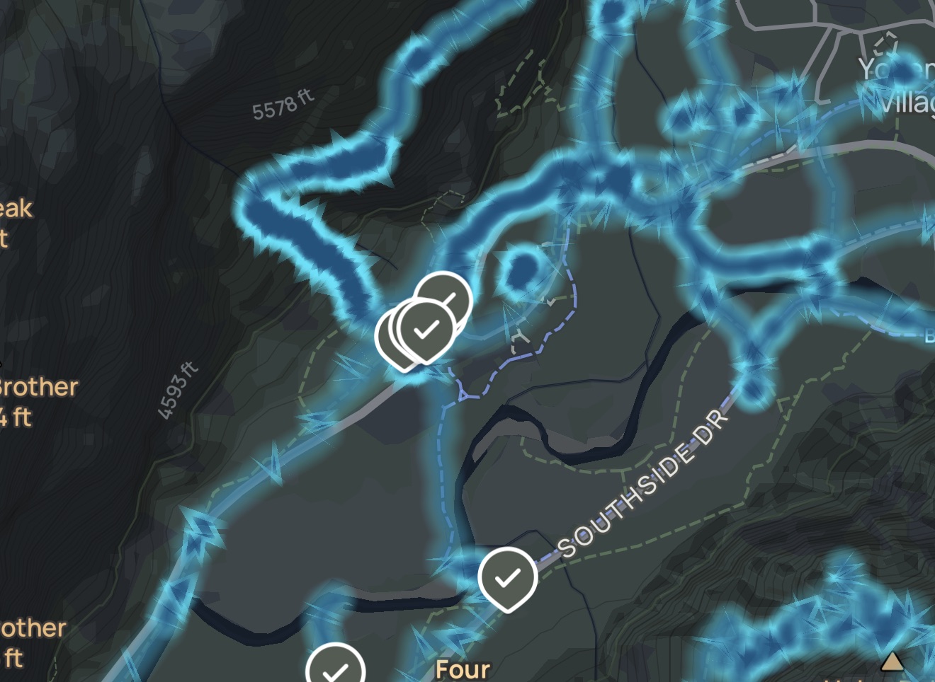
There’s another challenge with scale. When looking at a map with hundreds of lines, it’s hard to tell a 40-mile backpacking trip from a short afternoon hike without clicking into each activity.
Once I do select something, moving back and forth between an individual route and the larger map can also require a lot of zooming and repositioning.
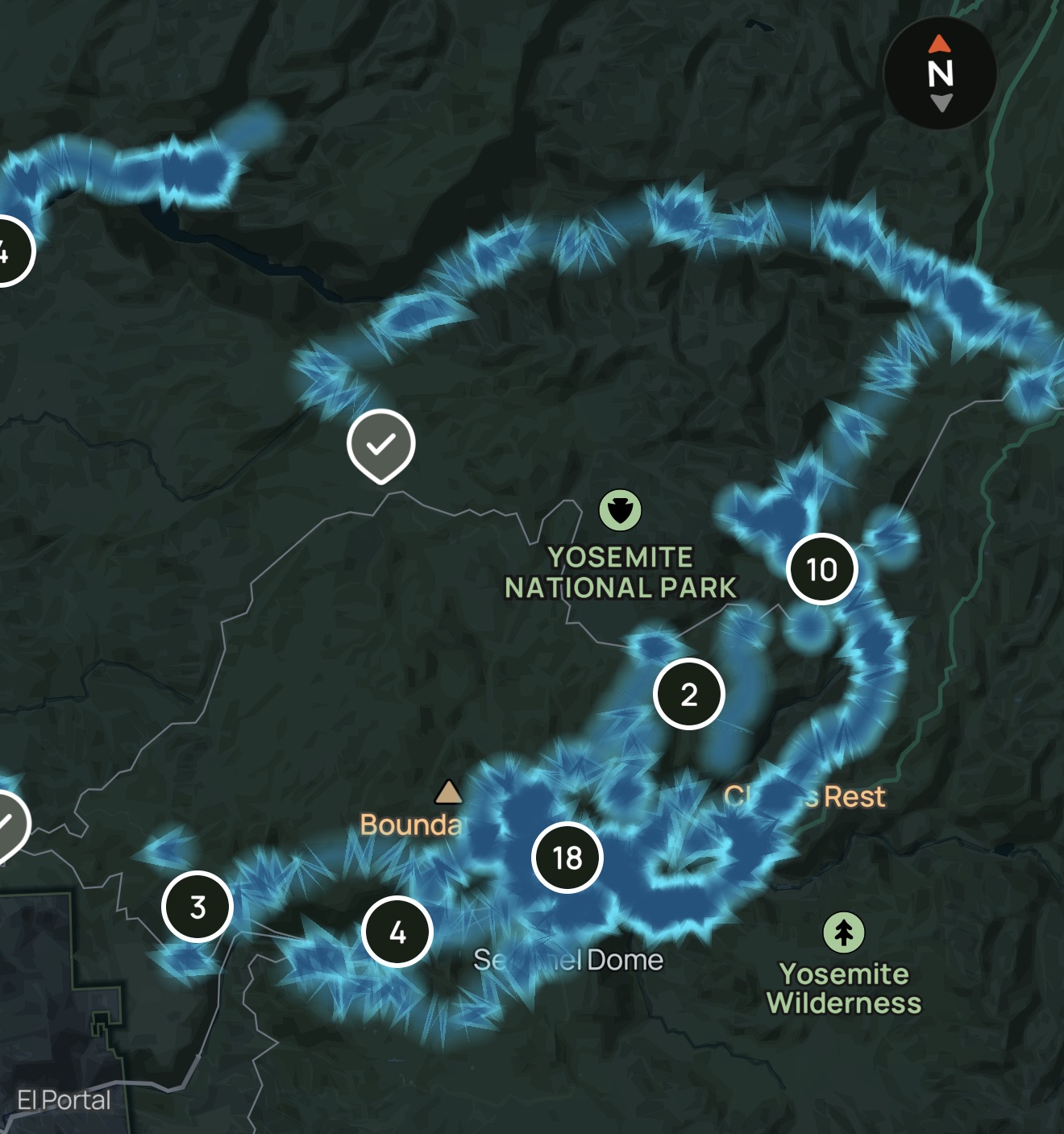
None of these are major problems on their own. Together, though, they make browsing a large activity history harder than I think it needs to be.
What I prototyped
I built my own activity map prototype to test a different way of navigating a large personal activity history.
The biggest change is connecting the map to a carousel of activity cards based on the current map view. Instead of relying entirely on clicking small or overlapping routes, users can browse the activities currently visible on the map.
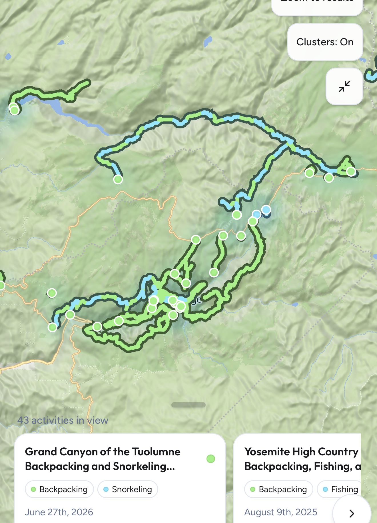
The map and cards then work together:
- Hovering over or touching an activity card highlights its route on the map, making it easy to identify without leaving the current view.
- Selecting a card focuses the map on that route and gives the user a clear option to view the full activity on AllTrails.
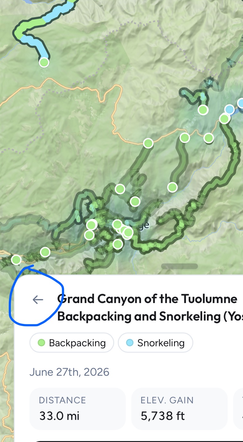
- A back control returns the user to the previous map view instead of requiring them to manually zoom back out.
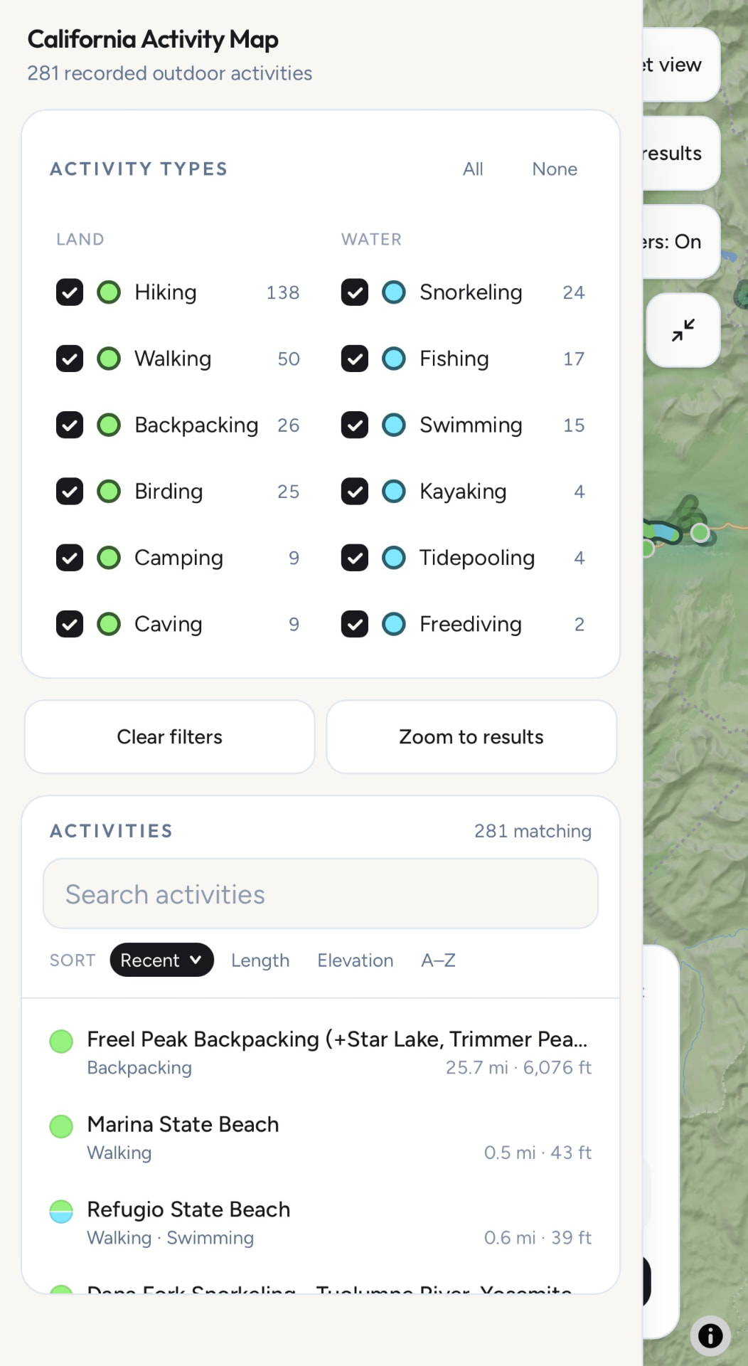
- Activity filters make it possible to isolate hiking, backpacking, paddling, or even specific activities.
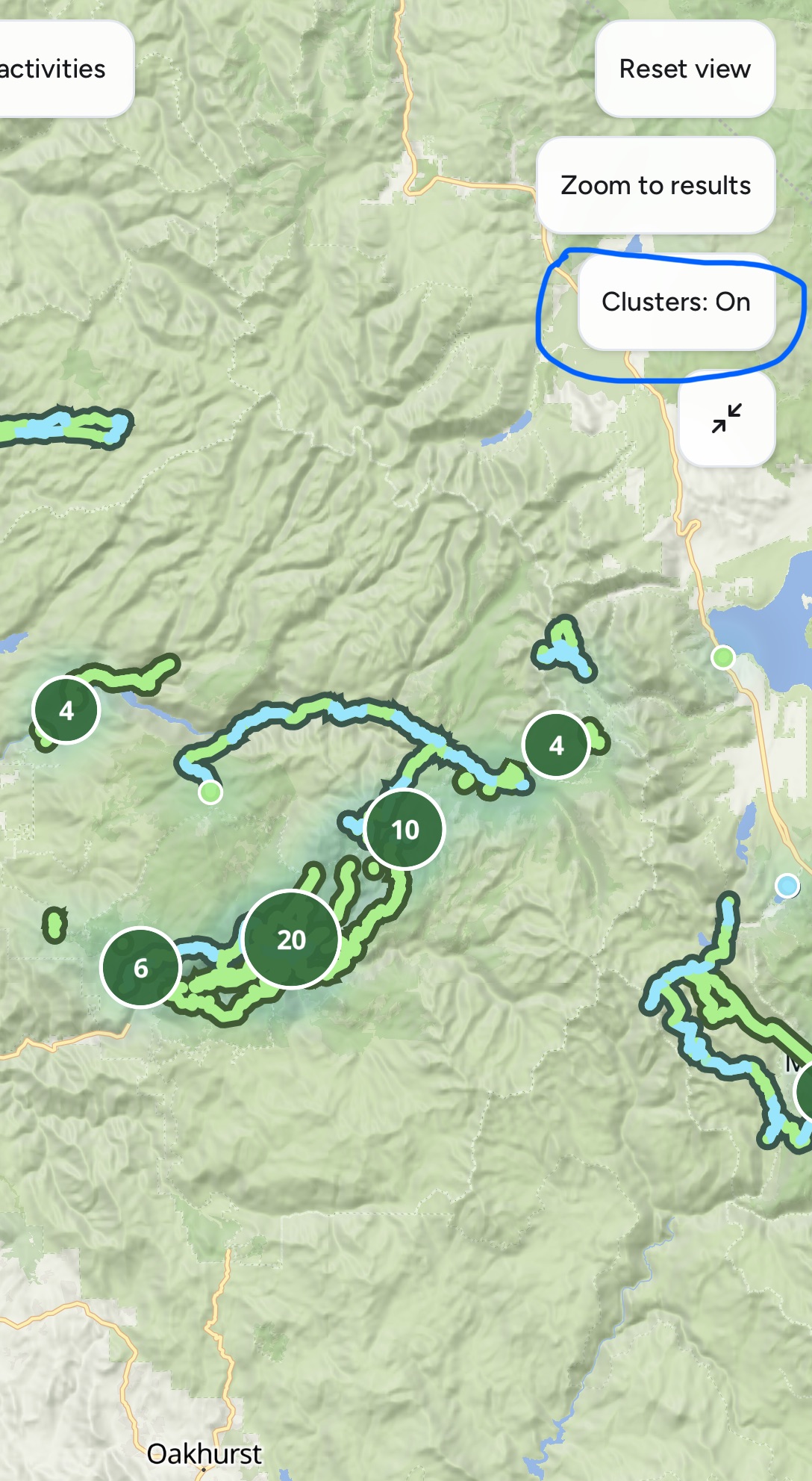
- Clustering can be toggled on and off, keeping it useful for navigation while also giving users the option to see the full map of their activities.
1. Hovering over or touching an activity card highlights its route on the map, making it easy to identify without leaving the current view.
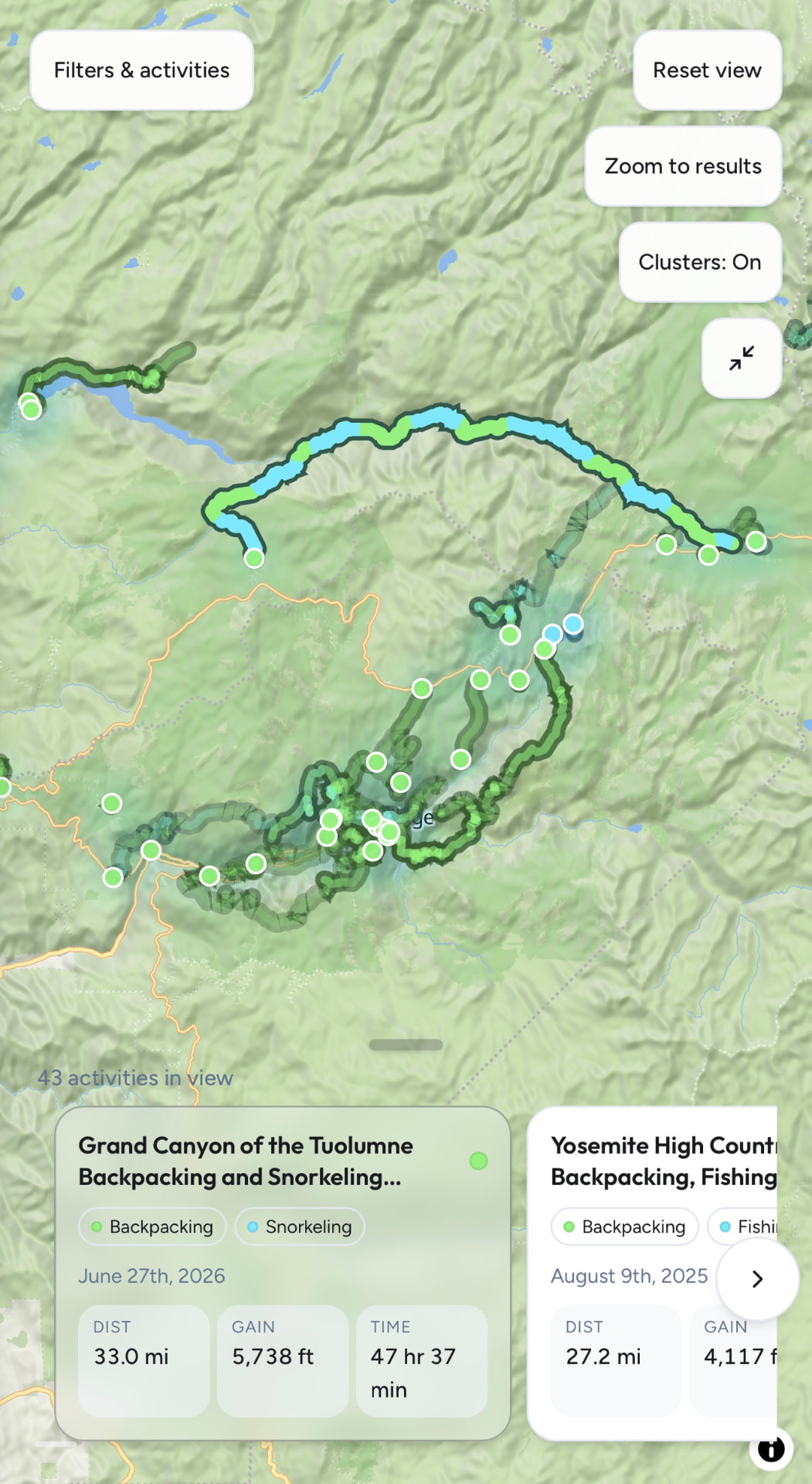
2. Selecting a card focuses the map on that route and gives the user a clear option to view the full activity on AllTrails.
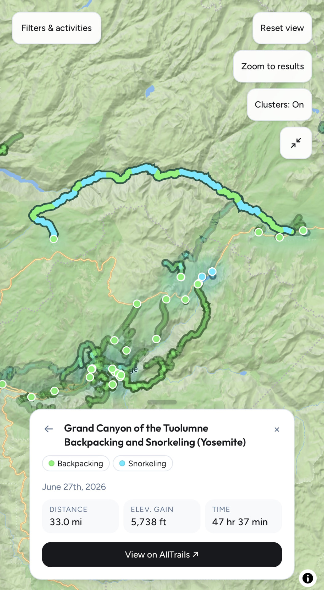
3. A back control returns the user to the previous map view instead of requiring them to manually zoom back out.
4. Activity filters make it possible to isolate hiking, backpacking, paddling, or even specific activities.
5. Clustering can be toggled on and off, keeping it useful for navigation while also giving users the option to see the full map of their activities.
I also wanted the experience to work well across desktop and mobile. On desktop, hover states can quickly connect cards with routes. On mobile, where hovering isn’t possible, the same interactions need to work naturally through taps and swipes.
The bigger opportunity
What interests me most about the activity map is how it connects reflection and discovery.
A lot of activity-tracking features answer the question, “What have I done?” A good personal map can also make you ask, “Where should I go next?”
That can create a useful loop for both the user and AllTrails. Exploring leads to recording activities, those activities make the map more meaningful, and the map can then inspire more exploration.
For someone who has built up years of activity history, the map becomes increasingly rewarding to revisit. Seeing that history take shape can also create a small incentive to keep exploring - and keep adding to it.
My prototype is one take on how that experience could work.
Want to take a look? View the activity map prototype →